
Trusted by 100,000+ professionals worldwide
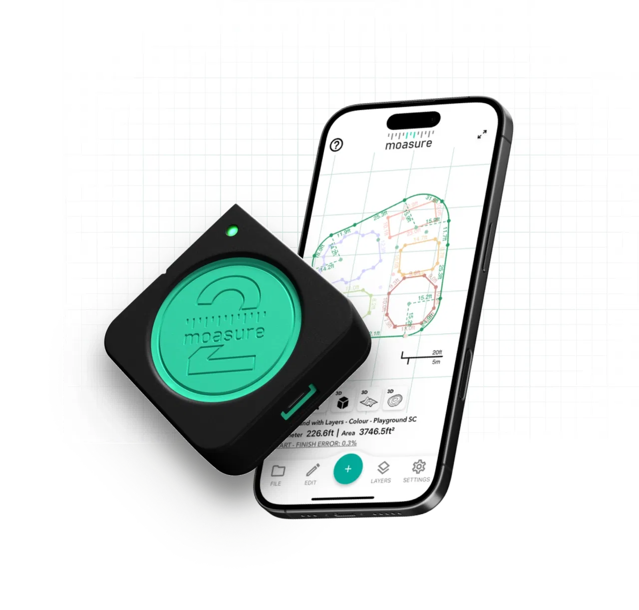
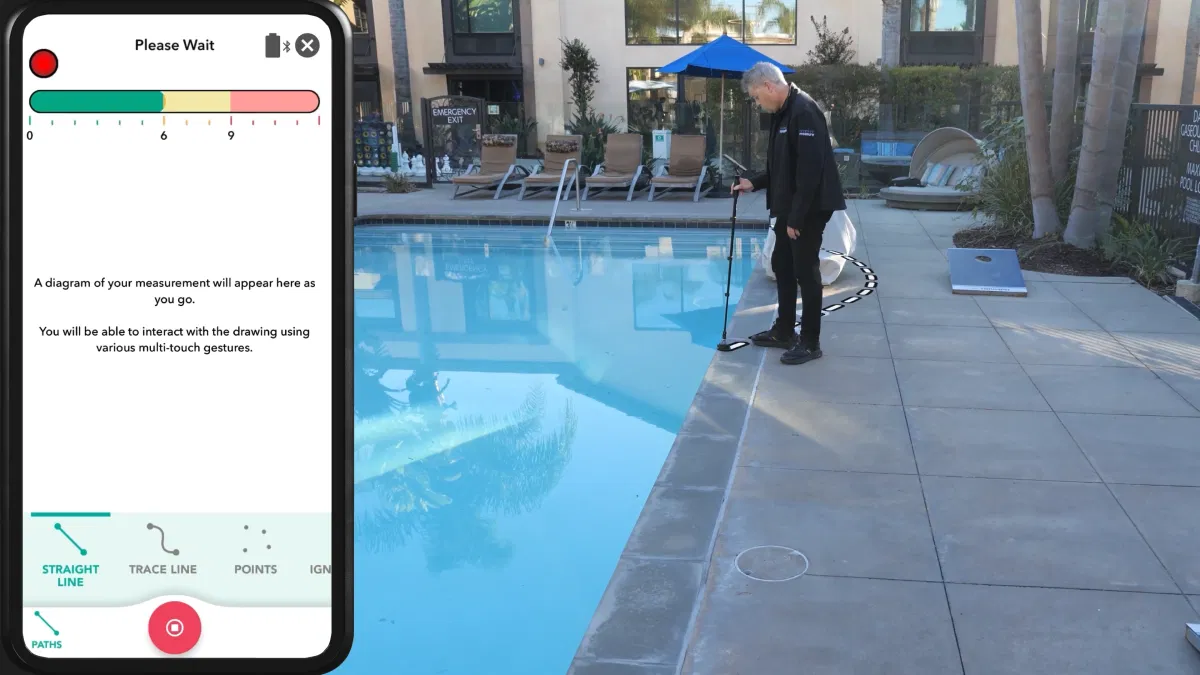
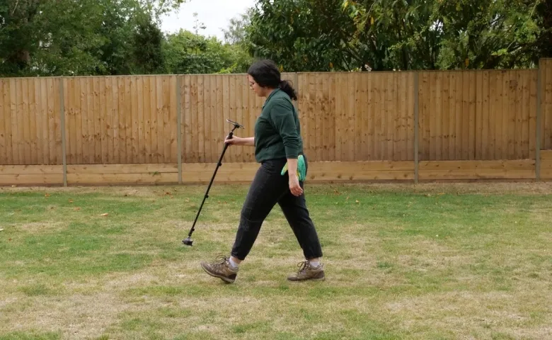
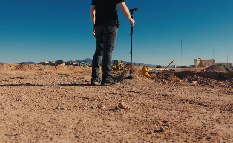
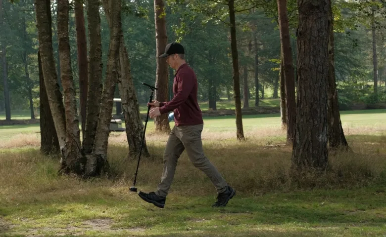
Turn site walks into site plans with Moasure
Measure area, distance, elevation, and volume as you walk.
Moasure is a pocket-sized device that transforms your movement into fully-dimensioned site plans. No line of sight, or extra hands required.
Moasure is a pocket-sized device that transforms your movement into fully dimensioned site plans. No line of sight, or extra hands required.
No GPS, signal, or internet required
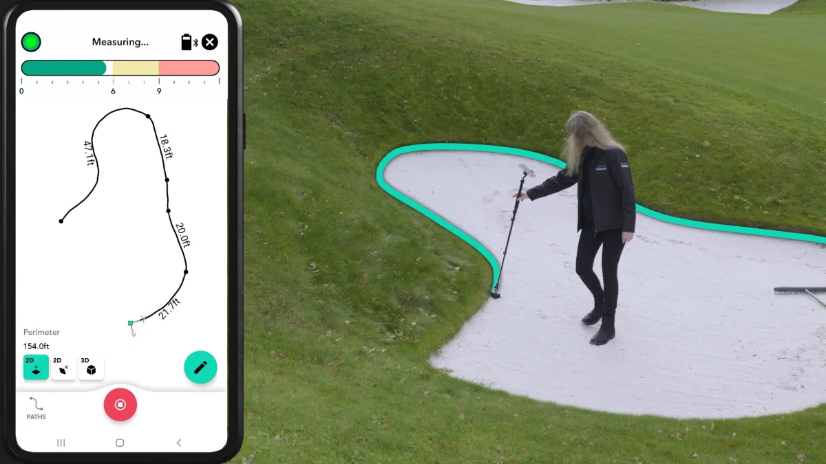
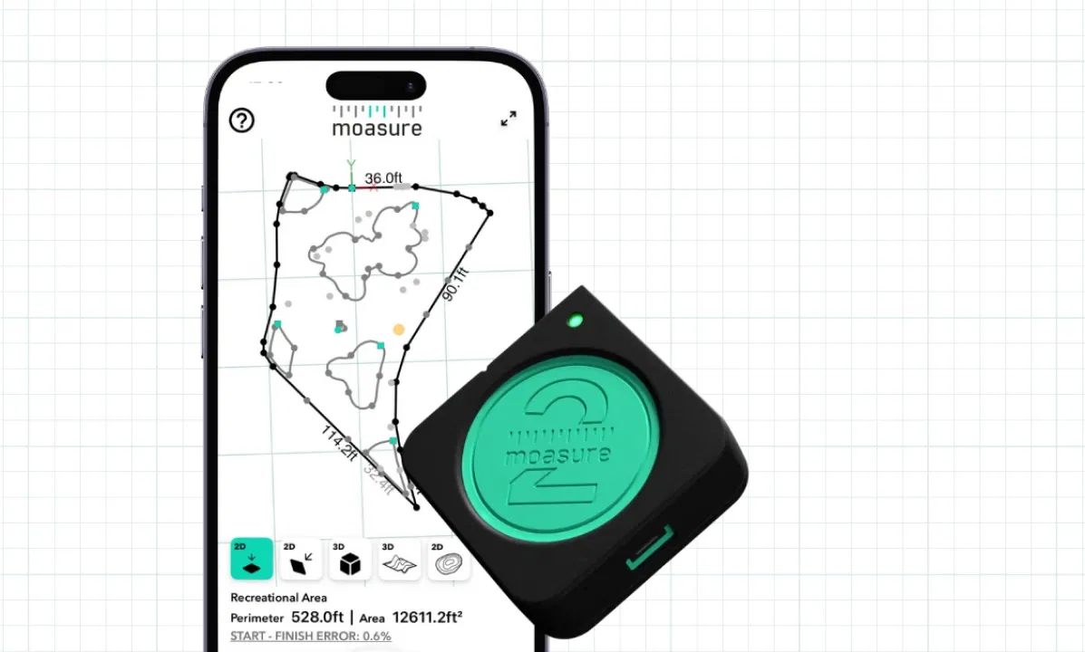
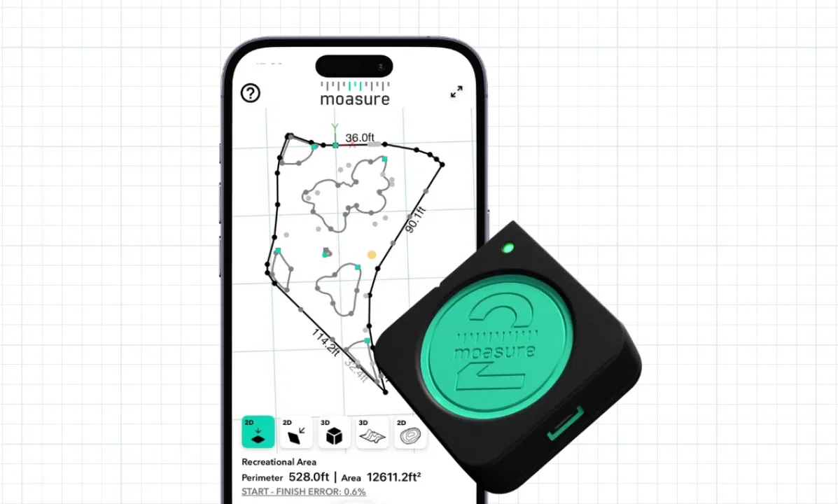
Create 3D plans by tracking motion
Reliable, with up to 99.7% accuracy
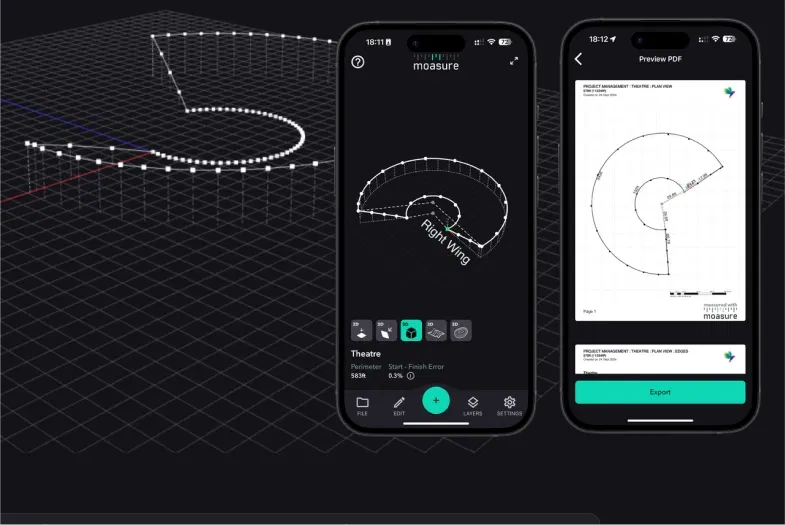
Export to PDF, CAD, and more
The motion-based measuring tool
Moasure connects to the free app via Bluetooth, working reliably without cell service.
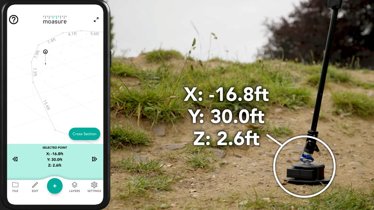
Capture x, y, and z coordinates
Instantly generate 2D and 3D plans
Save, edit, and export to PDF and CAD
Measure and draw at the same time
Create accurate site plans quickly. No pen, paper, or guesswork required.
Automatically capture site data – no notepads needed
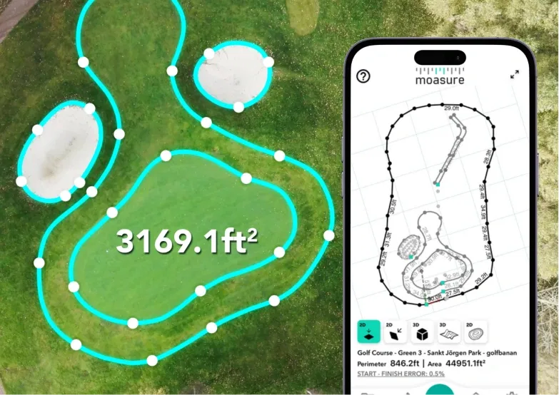
Moasure draws accurate site plans as you walk, inside the free companion app.
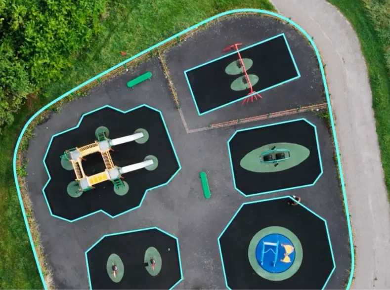
Calculate area, perimeter, elevation, and volume
Moasure does the math for you, and makes measurements instantly insightful through comprehensive 2D, 3D, and contour views.
Deliver professional plans that win more jobs
Create polished PDFs and CAD-ready exports in minutes. Impress clients and streamline handovers to colleagues.
Learn about Moasure’s core features
Whether you’re shooting grade, measuring sod, or leveling terrain, Moasure has a range of versatile tools to suit your needs.
Area and Perimeter
Learn how Moasure automatically calculates the square footage and perimeter of irregular sites.
Elevation and Grade
Learn how to measure rise, run, and grade between two measurement points.
Volume and Cut/Fill
Learn how to measure surface area, volume, and use the Cut/Fill tool.
Path Types
Learn how to use Path Types to capture the unique features of jobsites.
Layout
Moasure 2 PRO Exclusive
Learn how to locate entered X, Y points using Layout Mode with Moasure 2 PRO.
Export
Learn how to export files to PDF, CAD, and other formats.
The Moasure difference
Learn what makes our patented motion-based technology unique.
Reliable accuracy
Measure with up to 99.7% accuracy.*
Great for professionals who value speed and efficiency over cm-level accuracy.
±0.3% error for distance and elevation
±0.5% error for perimeter
±1% error for area
±1.5% error for volume
*Referenced measurement errors and accuracy are based on Moasure 2 PRO.
Learn more about accuracy
Fast and efficient
Get instant 2D and 3D plans by simply walking the site.
See your measurement come to life every time you set the device down.
Measure and draw simultaneously
Instantly calculate area, perimeter, and elevation
Export to PDF, CAD, and more
No GPS, cell signal, or internet required
Versatile by design
One device, a range of possibilities.
From area and perimeter measurements, to grade and cut/fill.
Multiple measurement types
Indoor and outdoor use
Measures distance, elevation, volume, and grade
Measures complex irregular shapes
Built to last
Measure with confidence in rain, shine, or snow.
The Moasure 2 Series is built to withstand harsh working environments.
Water-resistant & dustproof (IP67 rating)
Impact resistant to drops from 6ft
Operate from 14°F up to 122°F
Covered by Moasure's 2-year warranty
Hear how professionals get results with Moasure:
Go beyond straight lines
Moasure adapts to your needs. Accurately capture the unique features of your jobsite.
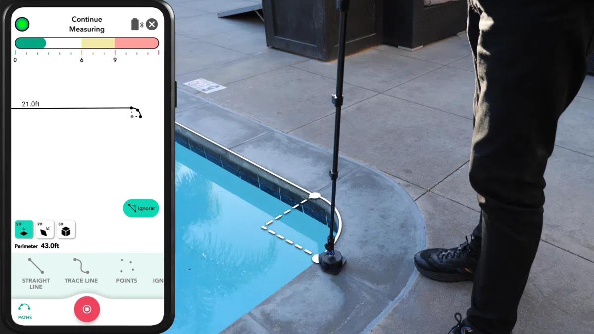
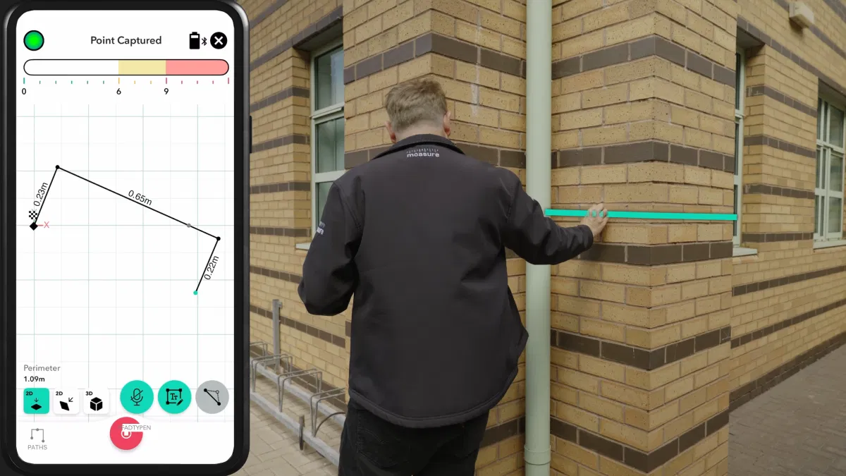
Measure around objects
In Straight Line Path, the points at which the device is set down, are connected with a straight line – ideal for maneuvering around objects.
Trace irregular curves
Trace Line Path traces the exact movement the device makes. This path is ideal for measuring irregular shapes, such as lawns or pools with curved edges.
Capture spot elevations
Points Path captures individual points without connecting them with lines – useful for volumes, marking locations of interest, or for spot elevations.
Create smooth arcs
Arc Path enables you to measure arc length, angle, and segment area using a line of best fit between at least 3 measurement points.
Capture perfect circles
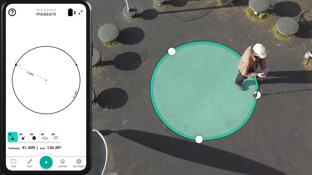
Circle Path draws a complete circle from at least 3 measurement points, and measures the radius, diameter, circumference, and area of a circle.
Map building footprints
In Wall Path, you can place the device on the face of each wall to automatically extrapolate corners and calculate square feet.
Choose the right Moasure for you
Moasure 2 PRO offers superior accuracy and consistency compared to Moasure 2.
Most Popular
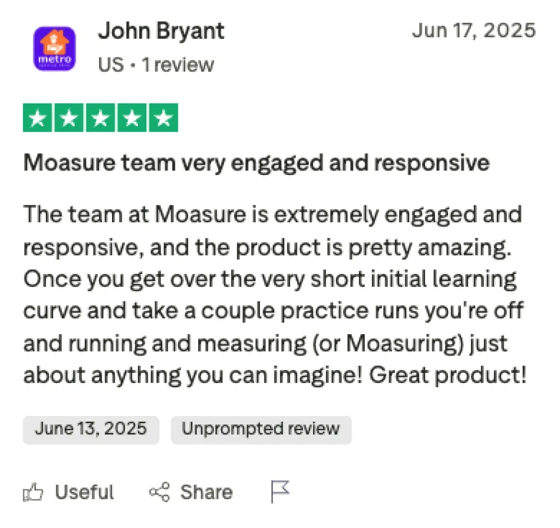
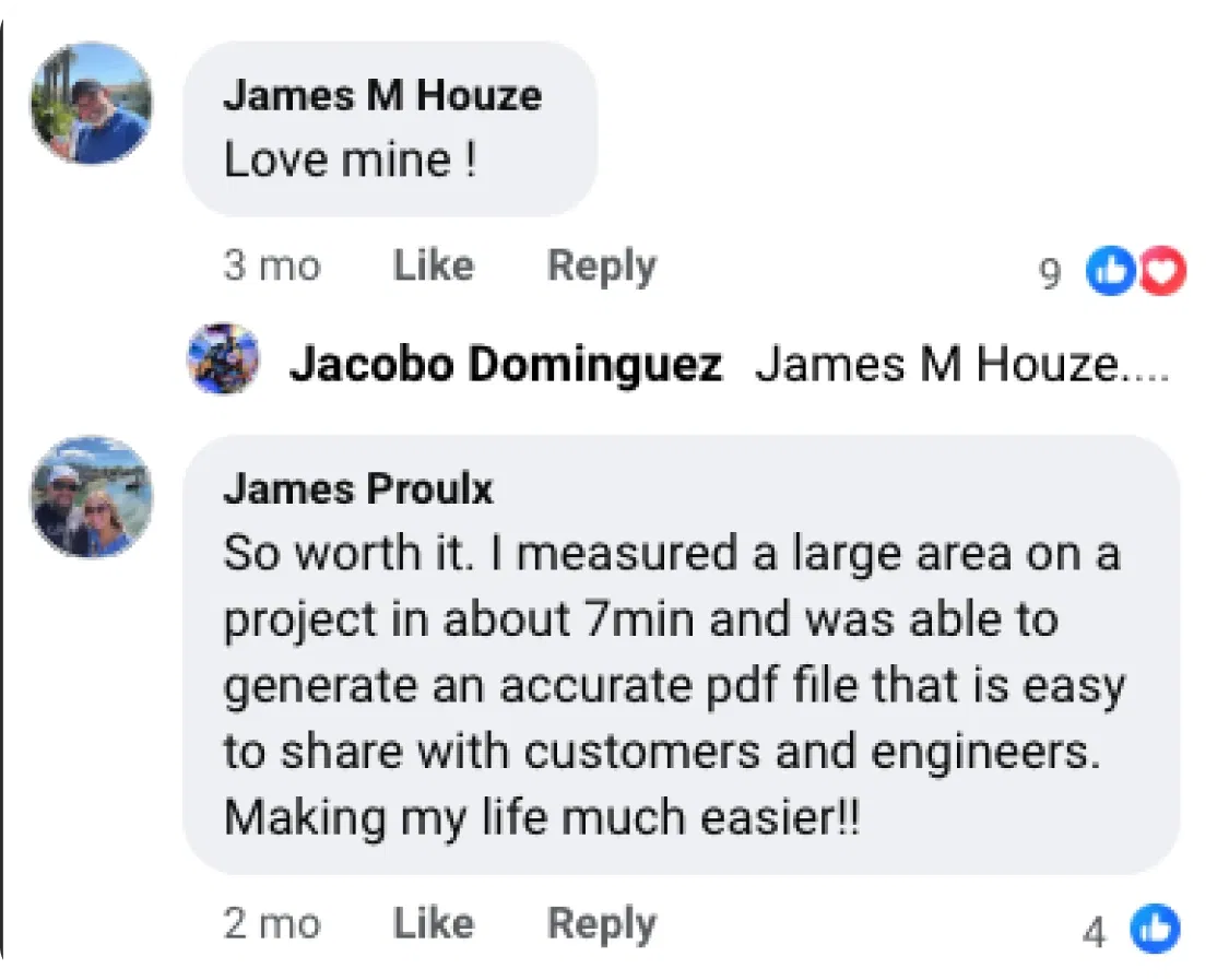
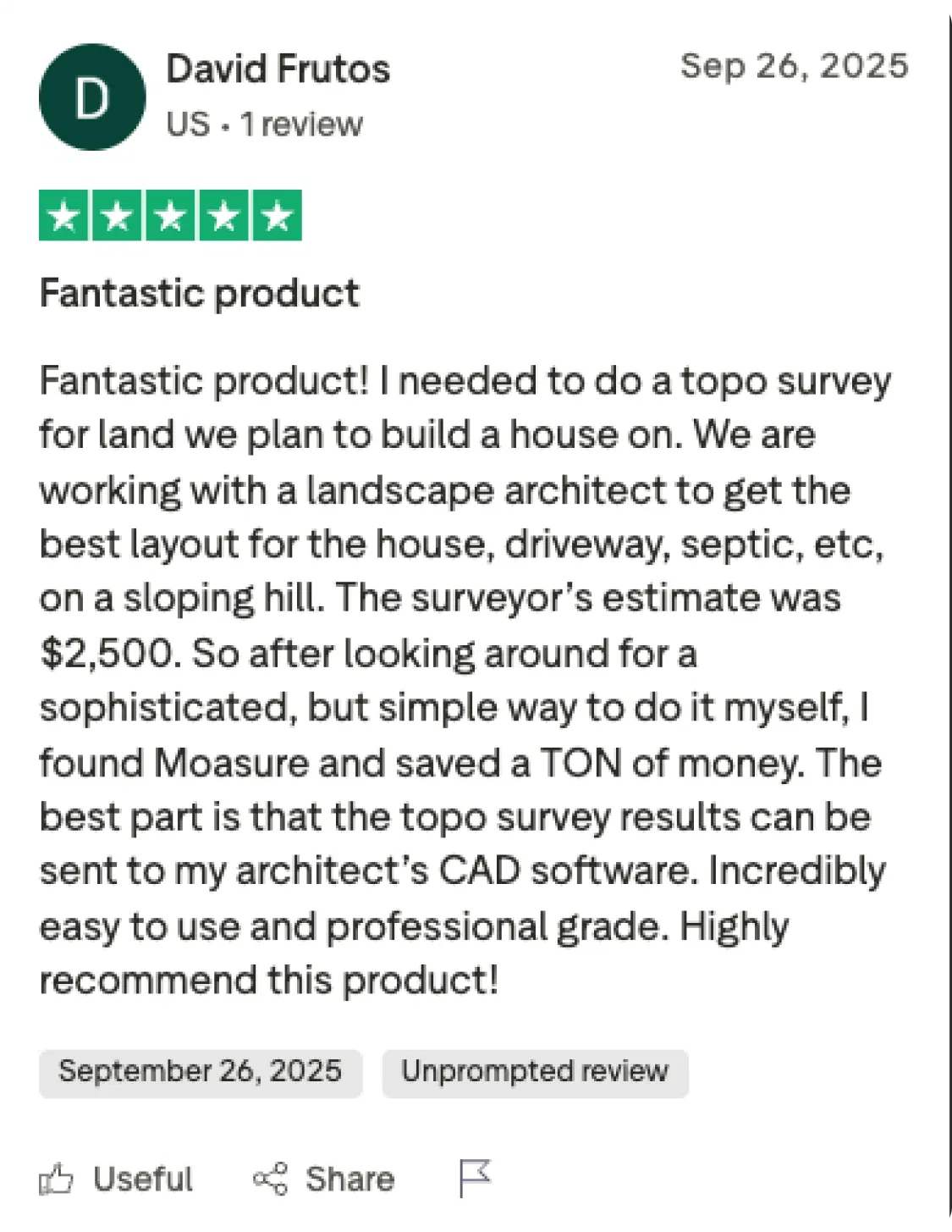
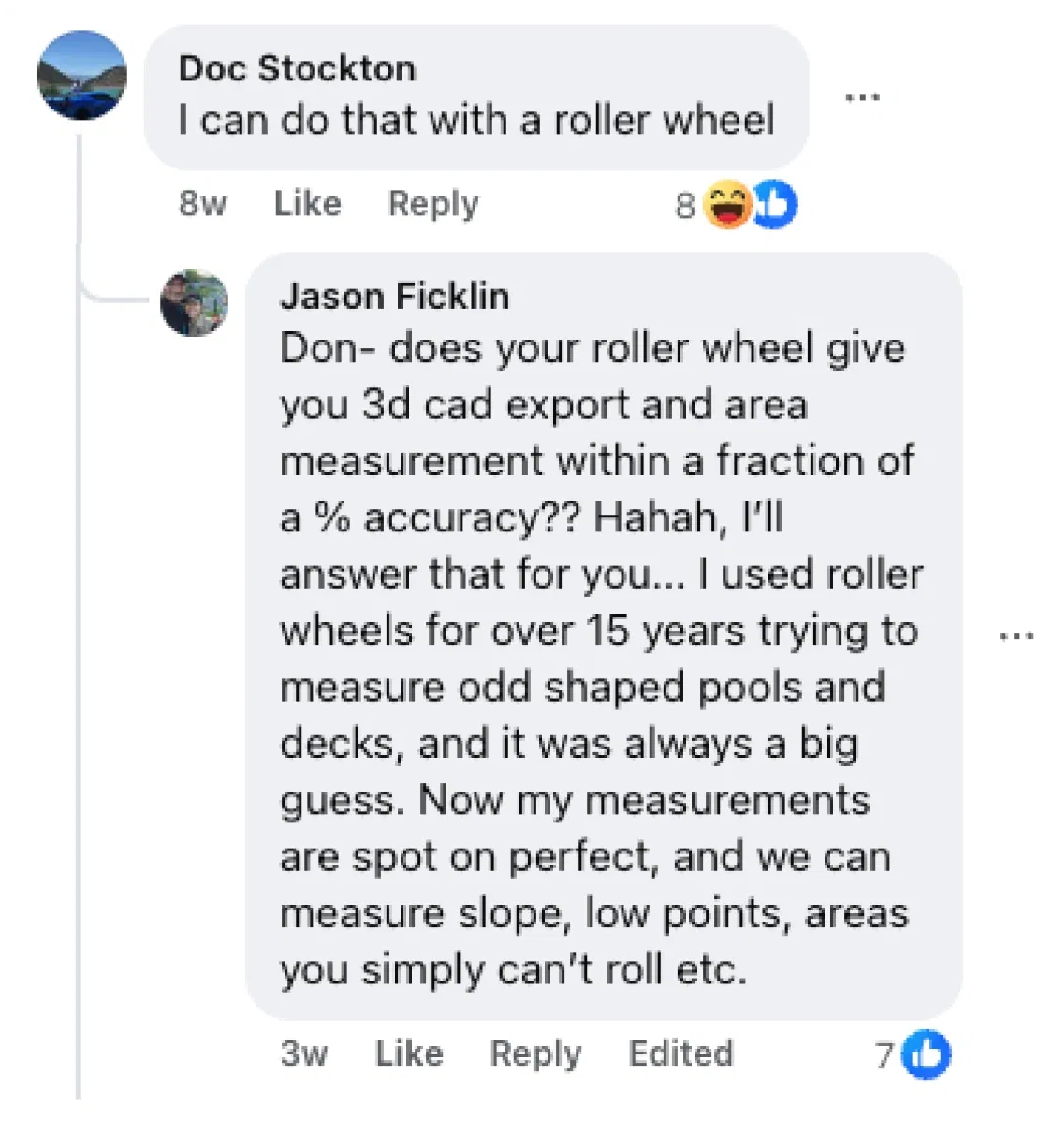
Raw and unedited testimonials:


Try Moasure risk-free for 60 days
Get the most out of Moasure – or get a full refund.
Moasure takes a little practice, but once you get the hang of it, you can cut hours from your workflow.
Our team of Moasure experts are on hand to guide you step by step.
If you decide it’s not for you within 60 days of delivery, just get in touch and you can return it for a full refund – no hassle.
Understand Moasure’s accuracy in detail
See worked examples of our accuracy values.
Linear Distance
±0.3% error
±2 inches over 50 ft

Elevation
±0.3% error
±¼ inch over 6 ft

Perimeter
±0.5% error
±6 inches over 100 ft

Area
±1% error
±2 sq ft over 200 sq ft

Volume
±1.5% error
±1.5 cu yd over 100 cu yd

Layout
±1% error
±2 sq ft over 200 sq ft
All stated values are reflective of using Moasure with proper technique.
Maximize your accuracy
See how Moasure fits into your workflow
Speak to a Moasure expert and discover how many hours you can save per week.


Speak to a Moasure Expert
Get your questions answered
Learn how Moasure can work for you
Book a live demonstration
Frequently asked questions
Learn more about Moasure's patented motion-based technology.
To achieve results within the max potential error, it's important to follow key techniques, such as: maintaining a fast pace, placing the device quickly and gently, and rotating it gradually.
Moasure 2 PRO
Linear Distance & Elevation: ±0.3% (Max potential error of 0.09ft over 30ft)
Perimeter: ±0.5% (Max potential error of 0.5ft over 100ft)
Area: ±1% (Max potential error of 30ft² over 3000ft²)
Volume: ±1.5% (Max potential error of 75ft³ over 5000ft³)
Layout Mode: ±1% (Max potential error of 30ft² over 3000ft²)
Moasure 2
Linear Distance & Elevation: ±0.5% (Max potential error of 0.15ft over 30ft)
Perimeter: ±1% (Max potential error of 0.5ft over 100ft)
Area: ±2% (Max potential error of 60ft² over 3000ft²)
Volume: ±3% (Max potential error of 150ft³ over 5000ft³)
Layout Mode: N/A
There's no fixed limit to the distance you can measure with Moasure. Instead, there's a limit determined by the available memory (RAM) on your smartphone or tablet.
As this varies across phones and tablets, we quote a 'safe' maximum distance of 1000ft and a maximum area of 100,000 sq ft to remain within the memory limit of most smartphones.
For areas larger than this, we recommend breaking up the measurement into a series of smaller measurements and stitching them together retrospectively in CAD software.
Some customers have measured distances of 2,500ft and areas of more than 269,000 sq ft in one measurement.
Moasure requires no subscription fees. After your one-off purchase, you receive complete access to our full suite of post-measurement tools, and you can export to CAD, PDF or CSV for free via the Moasure app.
The Moasure app is continuously updated for free to ensure that your Moasure device is supported with the latest tools and features.
We’re currently working on cloud-based storage of your measurements and a web editor, but it’s important to note that these optional features are not required to access all the benefits of your Moasure device.
Moasure doesn’t use GPS, which makes this tool ideal for measuring in remote locations without a signal.
Instead, Moasure uses motion-based measuring technology and a coordinate-based system, relative to the predetermined origin point.
To integrate Moasure into a workflow that currently uses GPS, we recommend using a separate GPS device to locate a known reference point as the origin for your measurement, and then export the Moasure data via CSV. All measurements can then be made relative to this known GPS coordinate externally.
Still have questions?
Chat with Moasure Bot.
Our virtual assistant can answer questions about product information, shipping details, and much more.
Moasure Bot
Trusted by professionals worldwide
Moasure is used by 100,000+ professionals across various industries.
Landscaping & Hardscaping
Fencing
Pool Construction & Design
Outdoor Living
Artificial Turf
Deck Building & Construction
Construction
Excavation & Groundworks
Concrete
Asphalt & Paving
Civil Construction
Sports & Recreation
Golf Courses
Playgrounds
Campsites
Sports Surfacing
Events Planning
Moasure 2 vs. Moasure 2 PRO
Understand the differences between our Moasure 2 Series range.
Choose a feature to compare
Accuracy
Moasure 2
Linear Distance: ±0.5%
Perimeter: ±1%
Area: ±2%
Volume: ±3%
Elevation: ±0.5%
Layout: Not available
Moasure 2 PRO
Linear Distance: ±0.3%
Perimeter: ±0.5%
Area: ±1%
Volume: ±1.5%
Elevation: ±0.3%
Layout: ±1%
Achieve up to 50% more accuracy and improved consistency with Moasure 2 PRO. This helps you to achieve tighter tolerances and reduce material waste.